Features
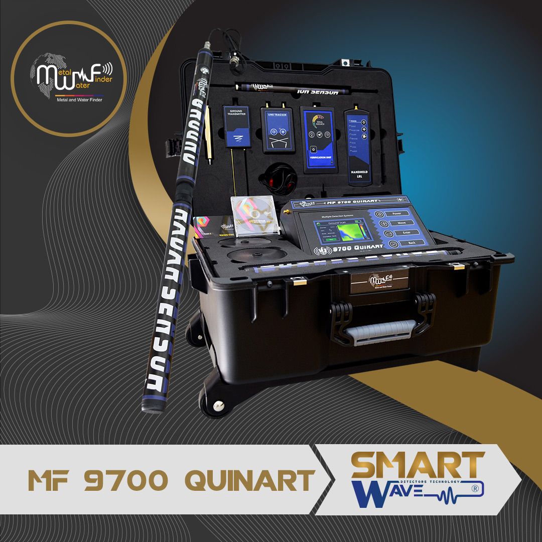
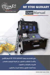
• MF-9700 QUINARY” this device works by most accurate and the latest Multi-detection systems that gives you reliable and complete results about the targets underground.
• Specializes in the detection and exploration for gold, treasures, metals, voids and groundwater, and distinguish between them, determine their locations within multiple search data about targets, types, sizes and depths as well.
• Software is a very sophisticated level of technology, gives the user a fast and easy control of all device settings and systems.
• The ergonomic design and streamlined shape gives you the power to search and navigate with lightweight and ease of use, which play a big role in quick and uncomplicated results.
• It has strong ability of search waves and frequencies with doubling energy, which gives it the ability to reach depths of up to 70m underground, with front search distance of up to 2 km, Note: The front distance may differ from system to other system so that each system has a limited ability to cover the search distance.
• TFT color screen 4.3-inch HD, gives the user the clear vision by night and day.
• Smart settings Interface, gives you a flexible and fast control in all the functions and programs with ease.
• Device’s general settings menu that gives you control of the following:
• Control the level of screen brightness feature, which gives you adequate lighting for day or night, and to reduce the level of lighting to save energy as well.
• Five levels of sound gives you adequate control of sound output and signals sounds of search results, as well as vibrator mode, or silent mode and sufficiency by visual results.
• Language control: gives you the control to change the device language that has already saved to another language.
• For the first time globally in the detection and exploration devices exclusively at MWF Group, The device supported with smart operating and detection systems, Smart interfaces, Power conservation system, Smart charging system, Multilanguage and remember device language, save settings, Smart control, Bluetooth technology and factory reset.
• Selection Interface of search system, it gives you a quick move between search system modes, to selecting search system, which detect through.
• Battery and charging smart feature, which gives the user accurate tracking of battery level and notices about battery level and alerts before the entry into force of power, with smart charging systems that give the user also follow up the battery charge when the device ON or OFF, and to find out the level of charging which added, all in real time.
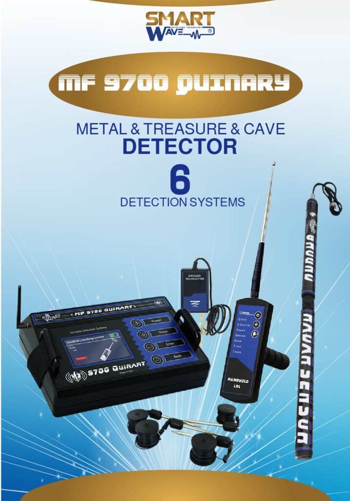
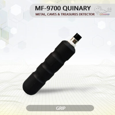
• The device and accessories featuring by small size, which giving quick movement with wireless communication orders, and subject to dismantling and assembly of all units and systems attached.
• Wireless connection System, to connect with the accompanying search systems, which sends a wireless orders to search system which to be exploration by it and change its settings remotely, without the need to connect the wires and other things that may impede and delayed the search process and results.
• Buttons Control Panel, composed of buttons made of chrome, gives you confidence in the rapid control in the device and settings.
• Automatic Tuning System (ATS) Special invention and new, registered in favor to MWF GROUP, this system provides accurate results and certain in all types of soils and terrain, because the system recognizes the soil automatically, grants the search process automatic tuning commensurate with the type of soil and properties of soil , With the abolition of any overlaps radiation resulting by the rocky and mountainous territory effect, which may affect a lot of other detectors, but the this smart system, can sorting and analysis and provide the necessary levels which relates of frequency signal, voltage and wavelength of the signal which gives results free of any errors.
Systems & Technical Specifications
| SEARCH SYSTEM: | 1. Teledetection ( Handheld LRL+ Line Tracker), 2. Ionic detection system (Acoustic), 3. Ground Sensor system, 4. Geophysical Survey System, 5. Ground Scan System ( Imaging Radar ) |
| SEARCH PRINCIPLE: | 1. Digital Frequency Signal Processing (DFSP) / To Receiving Electrostatic Fields of the targets, 2. Processing the Signal Received level of ionic radiation, 3. Detects the magnetic fields of targets and clarify the values., 4. Geology survey to measurement and processing the levels of electrical resistance, 5. Imaging the magnetic fields of ground, And analyzing and processing the results. |
| OPERATING PROCESSOR: | MICROCONTLLER PIC18 & ARM 7 |
| OPERATING SEARCH FREQUENCY: | 1. 1 kHz to 30 kHz, 2. 20 MHz, 3. 1 KHz to 10 KHz, 4. 1 MHz to 80 MHz, 5. 100 MHz |
| POWER: | 11.1 volts 6000 mAh |
| POWER CONSUMPTION: | Maximum of consumption 400 mA |
| BATTERY LIFE: | 8 work hours |
| CHARGER: | 14.8 volt 2 amp |
| DISPLAY TYPE: | TFT Color Monitor 4.3″ , 65536 Color, 48Mhz , CDMA GPU |
| SPECIALIZED TO DETECTS: | Gold – gold ore – Silver – Copper – Brass – Bronze – iron – groundwater – voids – gems. |
| TARGETS DISCRIMINATION: | Yes |
| TARGET SELECTION SYSTEM: | Yes, can choose the target type before start search from the list of targets, Or automatic detection of discovered target. |
| DEPTH SEARCH: | 70m for all targets and 450m for water with a control property in the depths level, through depths options list. |
| DISTANCE SEARCH: | 2000 m with a control property in the distance level, through distance options list. |
| RESULTS FEEDBACK: | 1. Through orientation toward target location accompanied by sound + visual + alerts., 2. Through sound, LEDs indicators and vibration., 3. Indicators of graphical data, sound, oscilloscope and signal strength, on the screen., 4. Automatic results about the target, type, name, depth on the screen., 5. Image results of the target shape. |
| BLUETOOTH: | none |
| WIRELESS: | yes |
| AUTOMATIC SMART GUIDANCE SYSTEM: | none |
| VOICE ALERTS: | Yes |
| VIBRATING ALERT: | Yes |
| OPERATING TEMPERATURE: | From -15° C to 60° C |
| STORAGE TEMPERATURE: | From -15° C to 40° C |
| HUMIDITY: | It can be stored and work in the degree rate of air humidity of level 90%. |
| WEIGHT: | 13 kg All accessories and parts |
| DIMENSIONS: | 26X20X9 cm Main unit |
| BAG DIMENSIONS: | 50X36X18 cm In the bag |
Detection and exploration systems supported by the device:
Teledetection Search System, and working by two systems (two methods) for detection.
Handheld LRL:
- Handheld LRL” works by long distance search system to detect the targets location, are guiding the user directly to the target site, with laser LED for guidance in the night.
- This unit operating on a 6-volt, through four standard AAA batteries 1.5 volt, can be used a normal batteries for once, or rechargeable batteries.
- Accurate results in determining targets underground to identify their paths and before reaching it.
Line Tracker :
- Line Tracker system, a special system to track electrical lines frequency that’s connected between the main transmitter device and the target point, It gives the user an accurate track until they reach the point of target directly, with the latest advanced systems for remote sensing systems by wireless connection.
- This unit operating on a 9-volt , through a single 9-volt battery, you can use regular batteries use a one-time, or rechargeable batteries
- Acoustic alerts rotating, which indicates the search process with volume control modes and silent mode as well.
Specifications of teledetection search system:
- Targets List, can choose any target from this list to search for it separately, and targets is : Gold, silver, copper, diamonds, ground water, caves and voids.
- Interface of accurate setting for search level, Multilevel to pre-control levels of depth and distance of the search:
- Depth up to 70 meters with a control property in the signal level of the searching depths, through depths options list , and starting from 0 up to the selected depth:1m – 5m – 10m – 20m – 30m – 40m – 70m.
- Distance search up to 2500m, with a control property in the level of front broadcast wave, through distance options list and starting from 0 up to the selected distance: 100m – 500m – 1000m – 1500m – 2000m.
- Smart settings Interface of the system with adjusted levels of search settings.
- Selection interfaces of detection method.
Ionic detection system ( Acoustic ):
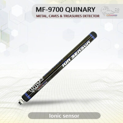
- Working on a long-range Ionian search system, to detect and search for Ionian field of precious metals underground, and locate the targets location from far distance, it can be used also in the car.
- Special Interface for this system, gives you preset setup of the target type want to search for: gold, silver, copper, bronze,
- Ionic acoustic verification unit is working and connecting wirelessly with the main device.
- The system is characterized by rapidly responding to the underlying objectives and gives complete data about the hidden target.
- A great focus in the search to sensing the targets sites, and guides the user to the target site at less time and effort as possible.
- This system gives the user multiple results, Consisting of the following:
- LEDs interactive Indicator, interacts upward whenever get close to point centre of targets.
- Sound interactive Indicator, interacts upward whenever get close to point centre of target.
- LEDs indicator of battery levels, and consists of 3 levels shows the battery level.
- Two internal cells of 3.7V Li-ion 3600 mAh, output 12 volt
Ground Sensor System:
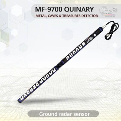
- Ground sensor system that works to scan of soil layers and get to know its contents and read fields and levels of magnetic radiation to detects and locate the locations of metal and voids underground.
- Smart interface gives you absolute clarity and integrated results about the targets.
- Accurate discrimination system between metals and voids.
- Oscilloscope graphics imaging system to determine the size of the target.
- Advanced sensors give immediate and direct results in real time.
- Accuracy Identify of the target point with a graphs on the screen.
- Smart verification system, about connecting the ground-sensor in the device are well, or not connected in the device.

Geophysical Survey System:
- The system works on measuring the intensity of the soil electrical resistance and to identify substances found underground and identification, and its mission to detect and exploration for gold, metals and voids underground with a property of accurate discrimination between the targets.
- This system scans and detect the soil automatically, and shows complete results about the discovered targets directly on the screen.
- Special display interface of this system, gives the user an integrated information about the search process and search steps are automatically.
- Feature of selecting types of targets discovered after scanning is complete then the system starts directs you to a site of this target point to know the full details.
- Feature of automatic help messages, which appear on the screen for the user to alerting on a particular command or guidance to execute a specific command.
- The system works by four electric probes to cover a large search area up to 1,500 square meters and show the results of this space over a period not to exceed 3 minutes.
- Property of determine the target depth and accurately, through a special system to identify and measure the depth of discovered target.
- Advanced Search and identification techniques, working on functions smart detection, which works on the smart systems of detection and analysis for the target location.
- Multiplier check scanning system and at the immediate time for the location, which gives the user, gives credible and proven results.
- Accurate discrimination between the targets types, and to clarify the target, type, size and name in the screen directly.
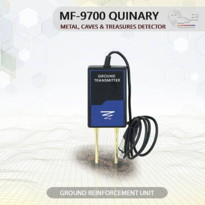
- Smart verification system of connecting the electrodes in the soil and by wire or non-connected, and clarified it on the screen through the alerts messages.

Ground Scan System:
- The system works to detect and scan the ground layers, through radar imaging system to clarify the target format underground and sizes.
- No need to use the complicated analysis software and computer or other tablets, this device gives you immediate results on the device colourful HD screen, and at Real-time.
- Full control in imaging scanning process
- Automatic scan mode
- Manual scan mode
- Scan dimensions controlling through several options shows on the device’s screen
- Selecting scanning method you want to work out
- Measuring and Scanning Sensors, with modern and sophisticated scientific techniques, specialized to identify and detection of artifacts, objectives underlying, metal and caves with distinguish between them.
- Clarify the target size and shape, with full graphical about the target and type.


